UgCS DDC is a commercial software that enables the synchronization and control of dozens of drones simultaneously. This allows outdoor shows to incorporate a drone swarm seamlessly. The software also manages payloads for special effects, and is the first software designed specifically for drone swarm mission planning. It offers an immersive 3D environment that makes it easy to plan the path of the drones during a show.
UGCS
The UGCS drone command and control solution is based on the industry-leading UgCS drone mission-planning software. It’s designed to streamline integration of drones into SAR, law enforcement, and security operations. It supports a wide range of drone models and is easily integrated into existing infrastructure.
The software allows users to see telemetry data from multiple flight modes, including manual control with a remote control, or automatic flight with a flight plan. It also supports click-and-go flight modes and joystick controls. It also includes software emulators of quadrocopters and fixed-wing drones, including the emucopter and emuplane.
The UgCS drone fleet software has been used to produce a variety of drone applications, from drone light shows to geospatial data applications. In one such project, scientists from Stanford University used the software to survey a colony of Adelie penguins in Antarctica. Using multiple drones, they were able to finish the project in a fraction of the time it took them to do it manually. Tens of thousands of high-resolution images were captured on each survey. These images will then be used to build an AI model to count penguins in the colony.
In addition to providing the necessary drones for the show, the UGCS drone show creator allows users to create a visual representation of the show and easily integrate it into existing infrastructure. The software also allows users to add different effects to a multi-drone display. It also has an advanced algorithm that guides drones in different flight paths. This allows users to create a multi-camera drone show with ease.
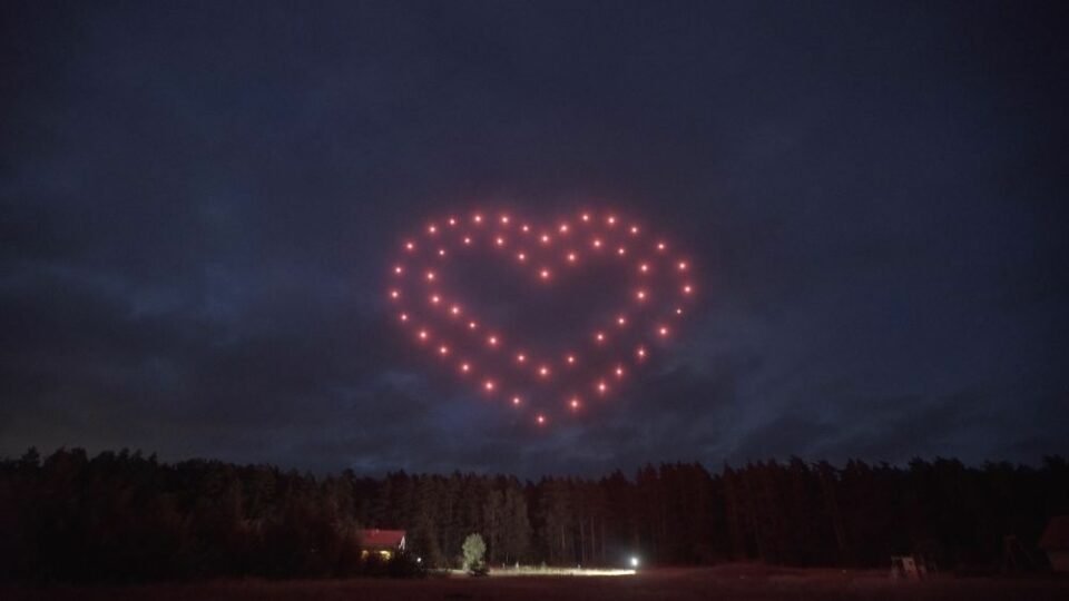
The UgCS drone show software was created by a Latvian startup, SPH Engineering. It allows entertainment industry professionals to create a drone swarm show in a matter of weeks. It also includes tools for incorporating drones equipped with lights and synching them with live performances. There’s no need for expensive equipment.
UGCS mission planner
The UgCS mission planner allows you to download a 3D globe with terrain elevation data. You can use this information to plan a drone mission with various altitudes above sea level. With the elevation profiles, you can see where your drone will be flying at all times. This way, you can make necessary adjustments to your flight plan and avoid flying too high or too low.
The UgCS also allows you to trigger your drone camera by distance and time, which is crucial for continuous photography and creating quality 2D or 3D models. The system can also plan a mission to be flown at a specific altitude, which increases the quality of 3D models. You can also use the UgCS to control a drone equipped with LIDAR.
The UgCS mission planner allows you to schedule your drone to fly to specific locations, which is useful if you want to capture progress in a construction site. For example, you can schedule a drone to fly around a point, and it will automatically face that point. UgCS also allows you to start and stop video recording. This helps to keep the length of your video short, so that it does not fill up the memory card.
In addition to the UgCS mission planner, the company also offers drone swarm software. This software supports the DJI M300 and Phantom 4 RTK, as well as Ardupilot, PX4-based platforms. It also supports more advanced drone models, including the DJI M600.
The UgCS mission planner allows for aerial surveys and mapping. The software provides pre-installed cameras or the ability to create custom camera presets. It also allows you to adjust the parameters of the cameras for accurate results. You can also see the elevation profile of your route with this software.
UgCS mission planner is an excellent choice for controlling hundreds of drones. It includes a variety of useful features that can help you create a unique show. The software is easy to use and supports a variety of DJI drones, Ardupilot systems, Px4 systems and more. It can also test the effectiveness of anti-drone tactics.
UGCS drone dance controller
The UgCS Drone Dance Controller is a software solution that lets you control an entire fleet of drones, including lights, fireworks, smoke generators, and other payloads. It also allows you to plan choreography and manage the entire set of drones from a single computer. This controller can control up to 100 drones simultaneously.
The UgCS client is the main interface for the UgCS drone dance controller. It contains several tabs, including the Actions and Options tab, Vehicle Selection tab, Filter by Operator, Vehicle Status column, Route’s Continue command, Stopwatch, and Commands to End Route. The UgCS client also allows you to set a landing waypoint.
The UgCS also has a mission planner and a Google Earth-like 3D interface. This allows you to plan your flights in a 3D environment, giving you even more control. In addition, you can see the elevation profile of the route you are about to fly. The UgCS also allows you to import KML files.
UGCS drone integration services
UgCS provides drone integration services for a variety of industries. These services include software for the drone’s flight controller and display, as well as software to upload and manage flight plans. The software also features multiple flight modes, such as manual flight where the pilot controls the drone with a remote control, or automatic flight where the drone follows a pre-determined flight path. In addition, UgCS offers software emulators for fixed-wing and quadrocopter drones, including emucopter and emuplane.
UgCS drone integration services are available for DJI drones as well as many other popular multirotors that use MAVLink. Currently, UgCS supports the M600/600 Pro, M200, M100, Inspire 2, and Phantom 4 (SDK controller only). The software also supports many other MAVLink-compatible multirotors, including Ardupilot, Mikrokopter, LockheedMartin Kestrel, and Indago.
For emergency services, UgCS flight algorithms can help search for missing people. Using new flying patterns, drones can be used to quickly cover an area. For example, the German Red Cross uses UgCS drone integration software to search for missing persons. This software takes the focus field of the drone’s camera into account and adjusts flight trajectory to quickly cover a given area.
UgCS drone integration services can also be used for police investigation and law enforcement. With the UgCS drone management solution, police officers can view live images from the drones in the field and at the command center. This helps them to make more accurate decisions and control the first responder teams more effectively. This could save lives.
In addition to drone integration services, SPH Engineering also offers unmanned systems software development. UGCS, or Unmanned Ground Vehicle Control Software, is an excellent platform for UAV land surveys and industrial inspection. Its suite of tools makes it easy to capture aerial photos and create 3D orthophoto maps. The software also supports the geotagging of aerial images.